
Cartographic
John Chapman’s map of Nottinghamshire (1774) is the earliest printed map at a sufficiently useful scale (1 statute mile to one inch) to provide basic information on town and village layout and the existence of landscape features such as roads, parkland and mills. A facsimile version was published by Nottinghamshire County Council in 2003.
George Sanderson’s map, Twenty miles around Mansfield, originally published in 1835, covers most of Nottinghamshire at a useful scale of 2¼ inches to 1 mile (showing fields, individual buildings, roads, industrial sites, parish and township boundaries, etc) and a reproduction has been published by Nottinghamshire and Derbyshire Library Services.
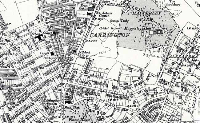 Extract from Ordnance Survey 6" to 1 mile map of 1920 showing the suburb of Carrington. Reproduced with the permission of the National Library of Scotland (http://maps.nls.uk/index.html)
 Ordnance Survey
Large scale Ordnance Survey maps from the late 19th and early 20th centuries show Carrington in great detail:
- 1:2500 (25” to the mile) and 1:10560 (6” to the mile) published in 1885 (1st revision in 1901; 2nd revision in 1920; 4th revision, c.1947)
These maps can be consulted at Nottinghamshire Archives or the local studies sections at Nottingham Central Library or Sherwood Library. They are also available online:
- Nottinghamshire Insight Mapping (select 'Historical' from the pull-down menu at the top of the screen)
- National Library of Scotland Ordnance Survey Maps
Manuscript
Archives and Special Collections, University of Nottingham
Several maps of property in Carrington are listed on the Archives and Special Collections Online Catalogue