
Overview
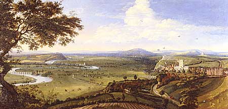 |
Impressive panorama of Nottingham and the River Trent by Jan Siebrechts, 1700. (Image courtesy of Nottingham City Museums, Nottingham Castle Museum). |
The landscape of an area is perhaps the most primary source of all for local historians. Frequently taken for granted by those who live in or pass through it, the current landscape provides a depth of information which is almost inexhaustible. It is a common platitude that rural landscapes are unchanging, but this is rarely the case in Nottinghamshire, where there is evidence of human habitation stretching back at least 100,000 years. The exciting thing about landscape history is that the current lie of the land contains many clues to past influences and events and is an extremely complex picture recording the synthesis of humans interacting with nature through time.
The nature & location of resources:
Sources to research the history of a landscape are extremely varied. If the area under consideration contains natural or man-made features dealt with in other Research Pathways, please refer to these. For an overall study of an area some fieldwork is essential to understand the relief and layout of the land. This will also alert the researcher to the variety of land use, buildings and other landscape features. This examination of the current landscape can supported by both contemporary and historic maps and topographical illustrations and photographs.
Topographical illustrations rarely exist before the seventeenth century and are most common for the late eighteenth and nineteenth centuries. Photography became widespread only from the 1850s. In both cases the illustrations were rarely used to depict all landscape features equally. Much topographical illustration aims to show an important building or natural feature.
The cartographic coverage of an area can be far more extensive. The printed Ordnance Survey maps of the area will be available at least the scale of 1 inch to a mile from the 1830s. Before this, the printed county maps that date back to the 1570s give only the most stylised information about the landscape. Far more useful are the manuscript maps prodced largely for estate management or legal cases. Their availability is dependent upon the nature of land ownership, the date and extent of enclosure of commonable land, whether the land lay within the royal forest of Sherwood or whether it was subject to a legal dispute. All of these circumstances frequently resulted in the creation of manuscript maps of all or part of the area in question, which can date from the end of the sixteenth century to the nineteenth century.
![]()
![]()