
|
Subject aspects |
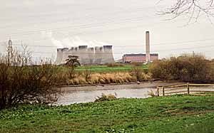 |
| Cottam power station on the River Trent. |
Subject overview
Rivers are fundamental landscape features in any location. As a source of water for consumption and irrigation they are often the focus of human settlements. Also the point at which they can be crossed with ease is another important factor in the location of towns, villages and roads. Rivers have also been a source of power for centuries, mainly for mills to process corn, cloth and metal. Rivers are very dynamic features of the landscape and are subject to both long-term and short term change in size and direction. Despite this, they have long been used as markets for administrative boundaries from estate to county level.
The nature and location of resources
Sources to research the history of rivers are rather disparate and are not standard for every watercourse in the county. Often the evolution of the course of a river has to be determined by incidental references in other sources where the river in question has been used as a boundary indicator or other structural landscape features are orientated around it. As with many other subjects, legal disputes featuring rivers often yield the most detailed information, although only for specific parts of the watercourse.
1. Structural
(a) Standing buildings
- Mills [TTS, vol.60]
2. Cartographic
(a) Printed
The Trent and other major rivers in the country are shown diagrammatically in plate... of Michael Draytons Polyolbion (1621), a long poetic account of Britain using rivers for the core narrative structure. (copies of maps in NCL)
- County maps, 1576-1820s (NLSL; NAO; BL) [see TTS, 34]
- OS maps, 1840s > (NLSL; NAO; BL)
(b) Manuscript
- 14thC - 19thC (PRO; BL; NAO) [see Nichols, 198..]
- TSRS 40 for rivers in Sherwood Forest
- 1595 (portion of Trent) [TTS, vol.87]
3. Graphic
(a) Photographic
.................................(NLSL)
- North Nottinghamshire from the Air (Retford, 2000)
- Trent in Old Photos (19...)
- Leen in picture postcards (19...)
(b) Film & video
(c) Artistic
- Trentside exhibition catalogue (Djanogli, 2001)
- Plates in Thoroton (1677), and Throsbys reprint of 1790
T W Hammond....................
4. Archival/written
(a) Official
- Severn Trent archives (UNMD)
- Quarter Sessions papers (NAO)
(b) Personal
(c) Administrative/business/economic
- Disputes regarding blockage of the Trent: RBN (1 or 2)
- Matersey & Everton tolls (NOA)
5. Printed
(a) Primary
- Navigable Rivers (1835)
- Commercial directories, 1800s to 1960s (NAO)
(b) Secondary
- Re. trade and transport on the Trent [TTS, vol 54]
- Re. Leen [TTS, vol 20]
- Hadfield, C.: Canals of the East Midlands (1966)
- Willan, T.S.: River Navigation in England, 1600-1750 (1936)
6. Oral
(a) Reportage
?
(b) Reminiscence
7. Artefactual
(a) Personal
- ? Retford Museum; Newark museum
(b) Domestic
- ? Retford Museum
(c) Community
- Hemmington Bridge timbers (Leics. Museums)
(d) Working
- Boats and navigational aids (Nottm Museums)
- Fish weirs (Nottm Museums)
- Tipstaff of the Mattersey & Everton toll collector (17thC)
© THOROTON SOCIETY OF NOTTINGHAMSHIRE | PAGE CREATED: 17 MAY 2002