
Cartographic
Ordnance Survey
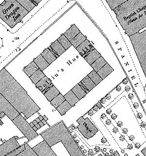
Extract from the Ordnance Survey 1:500 map of Nottingham (1882) showing Collins Almshouses on the junction of Park Street and Spaniel Row.
Large scale Ordnance Survey maps from the late 19th and early 20th centuries show Nottinghamshire towns and villages in great detail:
- 1:2500 (25” to the mile) and 1:10560 (6” to the mile) published in 1884 (1st revision in 1898; 2nd revision in 1916)
- 1:500 (10 feet to the mile) published 1884-86
The essential reference book for pre-19th century maps of Nottinghamshire is:
- H. Nichols, Local maps of Nottinghamshire to 1800: an inventory, West Bridgford: Nottinghamshire County Council, 1987
Abel Collin archives
Map showing location of Abel Collin Almshouses on Friar lane/Spaniel Row. Manuscript.