
Cartographic
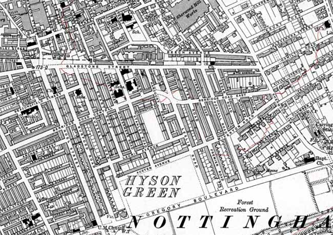 Extract from Ordnance Survey 6" to 1 mile map of 1920 showing the suburb of Forest Fields. Reproduced with the permission of the National Library of Scotland (http://maps.nls.uk/index.html)
 Ordnance Survey
Large scale Ordnance Survey maps from the late 19th and early 20th centuries show Forest Fields in great detail:
- 1:2500 (25” to the mile) and 1:10560 (6” to the mile) published in 1885 (1st revision in 1901; 2nd revision in 1920; 4th revision, c.1947)
These maps can be consulted at Nottinghamshire Archives or the local studies sections at Nottingham Central Library. They are also available online:
- Nottinghamshire Insight Mapping (select 'Historical' from the pull-down menu at the top of the screen)
- National Library of Scotland Ordnance Survey Maps