Cartographic
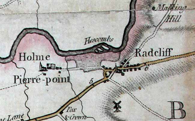
 Extract from John Chapman's map of Nottinghamshire published in 1776.
John Chapman’s map of Nottinghamshire (surveyed in 1774 and published in 1776) is the earliest printed map at a sufficiently useful scale of 1 statute mile to one inch to provide basic information on town and village layout and the existence of landscape features such as roads, waterways, parkland and mills. A facsimile version was published by Nottinghamshire County Council in 2003.
George Sanderson’s map of the county twenty miles around Mansfield, originally published in 1835, covers most of Nottinghamshire at a useful scale of 2¼ inches to 1 mile (showing fields, individual buildings, roads, industrial sites, waterways parish and township boundaries, etc). A facsimile version has been produced by Nottinghamshire and Derbyshire Library Services:
- George Sanderson, Twenty miles around Mansfield, 1835 (Reprinted by Derbyshire and Nottinghamshire County Councils, 2001)
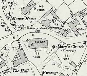
 The centre of Radcliffe-on-Trent as depicted on a 25" to the mile Ordnance Survey map published in 1914.
Large scale Ordnance Survey maps from the late 19th and early 20th centuries show Radcliffe on Trent and its features in great detail:
- 1:2500 (25” to the mile) published in 1884; second edition published in 1900; third edition published in 1914; later editions published in 1952, 1958, 1967 and 1977
- 1:10,560 (6” to the mile) published in 1883; second edition in 1901; third edition in 1915; later editions (at 1:10,000) in 1956, 1967, 1976 and 1990
Most of these maps are available online:
- National Library of Scotland: Ordnance Survey maps
- Nottinghamshire Insight Mapping
(Select ‘Historical’ from the pull-down menu at the top of the screen)
Manuscripts
University of Nottingham, Department of Manuscripts and Special Collections
- ‘A map of an estate belonging to Gervace Rozell Esq. lying at Ratcliffe … Surveyed by Thomas Hand in the year of our Lord 1710 [Ma 2 P115]
- ‘A map of the parish of Ratcliffe by W. Attenburrow and son in 1787 [Ma 2P 116 (photocopy)]
- ‘A map of the parish of Ratcliffe upon Trent … by W. Attenburow, Surveyor (1790) [Map Cabinet (EA)]
- ‘A plan of such part of the Grantham Canal as is intended to pass through the Liberties of Holm Pierrepont, Ratcliffe and Stragglethorep, made in October 1791’ [Ma 2P 364 (iii)]
- ‘A plan of such part of the Grantham Canal as is intended to pass through the Liberty of Lamcote in the parish of Holmpierrepont 1792 [W. Calvert] [Ma 2P 365]
- ‘Map of lands at Ratcliffe upon Trent … belonging to the Right Honble Lord Viscount Newark, from a survey taken in 1801 by Wm. Attenburrow [Ma 2P 117]
Further information on the maps is available on the Manuscripts and Special Collections Online Catalogue.