
Cartographic
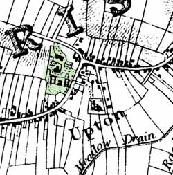 Upton Hall depicted on Sanderson's map of 1835
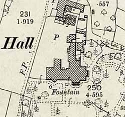
Upton Hall on the Ordnance Survey 25" to the mile map of 1899.
George Sanderson’s map of the county twenty miles around Mansfield, originally published in 1835, covers most of Nottinghamshire at a useful scale of 2¼ inches to 1 mile (showing fields, individual buildings, roads, industrial sites, parish and township boundaries, etc) has been produced by Nottinghamshire and Derbyshire Library Services:
- George Sanderson, Twenty miles around Mansfield, 1835 (Reprinted by Derbyshire and Nottinghamshire County Councils, 2001)
Large scale Ordnance Survey maps from the late 19th and early 20th centuries show the hall and its features in great detail:
- 1:2500 (25” to the mile) and 1:10560 (6” to the mile) published in 1879 (2nd edition in 1899; third edition in 1917; ‘Revision of 1938’ in 1947)
These maps are available online: