
Cartographic
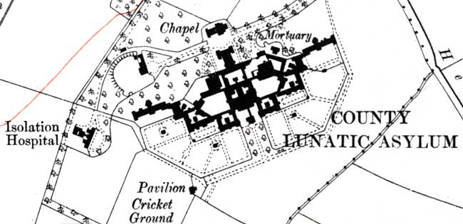
Saxondale Hospital as depicted on the Ordnance Survey 6" to one mile map published in 1915.
Large scale Ordnance Survey maps from the late 19th and early 20th centuries show hospital sites in great detail:
- 1:2500 (25” to the mile) and 1:10560 (6” to the mile) published in the 1880s (1st revision in the 1890s; 2nd revision in 1913-1919)
These maps can be consulted at Nottinghamshire Archives or the local studies sections at county libraries around Nottinghamshire.
They are also available online: