
|
|
|
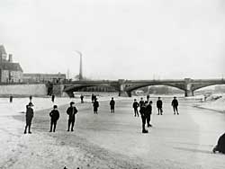 |
| Skating on the River Trent, Trent Bridge, Nottingham in the early 20th century. |
Subject overview
Rivers are fundamental landscape features in any location. As a source of water for consumption and irrigation they are often the focus of human settlements. Also the point at which they can be crossed with ease is another important factor in the location of towns, villages and roads. Rivers have also been a source of power for centuries, mainly for mills to process corn, cloth and metal. Rivers are very dynamic features of the landscape and are subject to both long-term and short term change in size and direction. Despite this, they have long been used as markets for administrative boundaries from estate to county level.
The nature and location of resources
Sources to research the history of rivers are rather disparate and are not standard for every watercourse in the county. Often the evolution of the course of a river has to be determined by incidental references in other sources where the river in question has been used as a boundary indicator or other structural landscape features are orientated around it. As with many other subjects, legal disputes featuring rivers often yield the most detailed information, although only for specific parts of the watercourse.
© THOROTON SOCIETY | CREATED: 17 MAY 2002 | UPDATED: 6 July 2003